Day 40: Mile 702.2 (Kennedy Meadows) to Mile 712.6
Miles: 10.4
Steps: 32,694
Elevation Gain: 2,430
After taking a week off to prepare for the upcoming months of snow travel, and visit family in Vegas, I was ready, and excited, to get back on the trail! I was also a bit nervous about making new friends, and a little scared for the snow adventures in my near future.
 I didn’t hit the trail until 2 pm… the hottest part of the day. I never expected a week off to affect me that much; however, it was a little bit of a challenging day.
  This might be attributed to the added weight in my pack (46lbs with the bear canister, ice axe, crampons, and warmer attire), or it could be that my body had forgotten how to sustain enough energy to hike all day. Whatever the cause, I just kept waking.
 I was a bit surprised by the gradual incline that I encountered, as I was expecting a much steeper ascent.
  The day started off in the desert again. I wasn’t too excited about that, especially since I thought I was past that stage! Little did I know, in a few days, I would be reminiscing of these snowless desert days.
  As the day progressed, there was more green. Not the desert green I had become accustomed to, but shrubbery green, and grass green…. real grass!!
  I don’t think I have ever been so happy to see grass.
Good news… I have successfully peed with my pack on, without peeing on my hip belt strap. Bad news… I’ve regressed and peed all over my untied shoe strings… without a pack on. When I master peeing in the wilderness as a woman, I should write a book: “Peeing in the Wilderness for Dummies”.
There were a lot of new faces today. All new faces, actually. The good thing was, it looked as though I would have company trekking through the snow. The down side… I need to step up my being social game and make new friends. I made it to a good tent site, and had planned on mingling with those around me, but was almost immediately attacked by millions of mosquitos. Mosquitos love me. I’ve read multiple theories on this… blood type, sweat, etc. Whatever the reason, I was bitten about 20 times before hiding in my tent the remainder of the evening. Mingling and friend making, had to wait.
Day 41: Mile 712.6 to Mile 733
Miles: 20.4
Steps: 60,580
Elevation Gain: 4,570 feet
The climb was still pretty gradual. I don’t know why, but I was expecting to go straight uphill into the snow, out of Kennedy Meadows. The last two days, I was pleasantly surprised with the grade of incline, for a change!  Snow appeared for the first time since Mount Baden-Powell, at mile 720.5 and around 9,042 feet. It wasn’t until over 10,000 feet, that snow started to cover the trail. Little did I know at the time, I wouldn’t be seeing much of the physical trail again.
The mosquitos were quite terrible all day. I honestly have never seen mosquitos in such high numbers as I did… ALL day. I could not get away from them. I had taken off my leggings half way through the day, but was forced to put them on again after getting bitten about 40 times, while trying to eat lunch. It didn’t matter, their little stinger nose, goes right through my leggings, and my Columbia hiking shirt, and my bandana. The only thing that saved me was being in my tent at the end of the day. It was so terrible. However, the views of the scenery kept me pretty occupied, so I didn’t get terribly annoyed.
I was pleasantly surprised with the section from Gomez Meadow to Death Canyon Creek. As I’ve said before, one of my favorite things about being on the trail is that the scenery can change so much throughout the day. The morning started through fields, across a beautiful wooden bridge, aside meadows, crossing beautiful rock structures in the middle of nowhere. It’s just so fascinating.
At the start of climbing the second mountain, I came across an awesome tent site with a beautiful view, so I decided to call it a night, as I was pretty pooped. It was the first night I had camped completely alone in weeks. The last time i camped alone, it was quite a crap experience, but this was quite the opposite, minus the mosquitos. 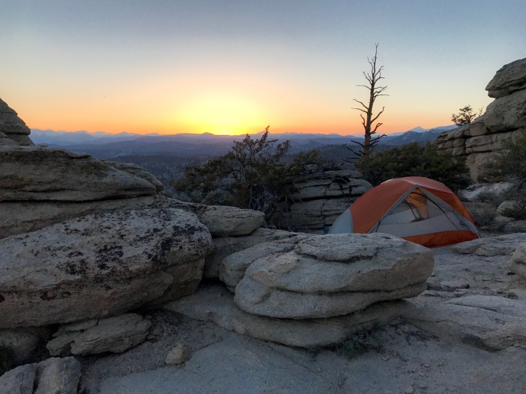 Things I love about camping alone: I don’t have to walk a 1/4 mile away to find a hidden place to pee; I can play my music as loud as I want, maybe even dance on the mountain ridge; i don’t have to wear ear plugs; I can move about on my squeaky sleeping pad as much as my big heart desires; I can wake up and eat Hot Fries at 1 am and not be concerned with the crinkling of the bag, or the crunching of the Hot Fries as they enter my mouth. Really, the only thing that I don’t like about camping alone, is, that my chances of being a bear, cougar, squirrel, or mouse attack victim, are much higher alone, than in a group. I feel safer in a group.
As I lay in “bed” I couldn’t help but wonder how on earth I could have been up since 430 am, hiked 20 miles in the heat and in the snow; climbed 4570 feet; got a sunburnt face (again); all while carrying 46 lbs on my hips and shoulders, and still not be tired. My alarm was set for 4 am and I was wide awake. I already knew the following day would be a struggle.
Day 42: Mile 733 to Mile 747.4
Miles: 14.4
Steps: 47,710
Elevation Gain:
I could probably fill the pages of a book, with the events that took place on day 42. And apparently I was too tired to write about all of them, so the following is what I recall from that day.
I know one thing, I wasn’t really prepared for the miles ahead of me. I had crossed a few snowfields throughout the day, but they ended shortly after they began, so I suppose that is what I thought the remainder of the journey was going to resemble. However, I came to a ridge, which was covered in snow, and seemed to never end. I kept telling myself that I would eat when it ended, but my body soon became weak and my stomach became impatient. I knew I needed energy in order to continue trekking in the snow.  After eating a 1500 calorie “snack”, I looked beyond the footsteps in front of me and saw what appeared to be never ending snow. I pulled out my crampons for the first time, and after about 30 minutes of figuring out how they worked and fitting them to my feet, I started moving again. My plan was to get to Chicken Lake and Summit Whitney the following day, but the snow navigation and walking, quickly stole all of my mental and physical energy; I became aware that trying to make it Chicken Lake was unrealistic, especially if the snow continued to cover the ground beneath my toes.
  Since Kennedy Meadows, I had been crossing paths with at least a dozen other hikers, but had recently passed the resupply trail exit for Lone Pine. A lot of people chose to get off in Lone Pine. I had been alone since that exit and feared I would be alone until my next resupply exit. Before you say anything, I knew it wasn’t smart being alone out there. Did I think I was more experienced than other hikers? That I was invisible to the dangers that lie ahead of me? Absolutely not.
  However, I wasn’t going to let the fact that I was hiking alone, stop me from continuing. I took my time… trust me. It probably took me 2 hours to go 3/4th of a mile on the snow. I made smart decisions. That was the best I could do. Trust me, I will make it home to my parents and furry best friend.
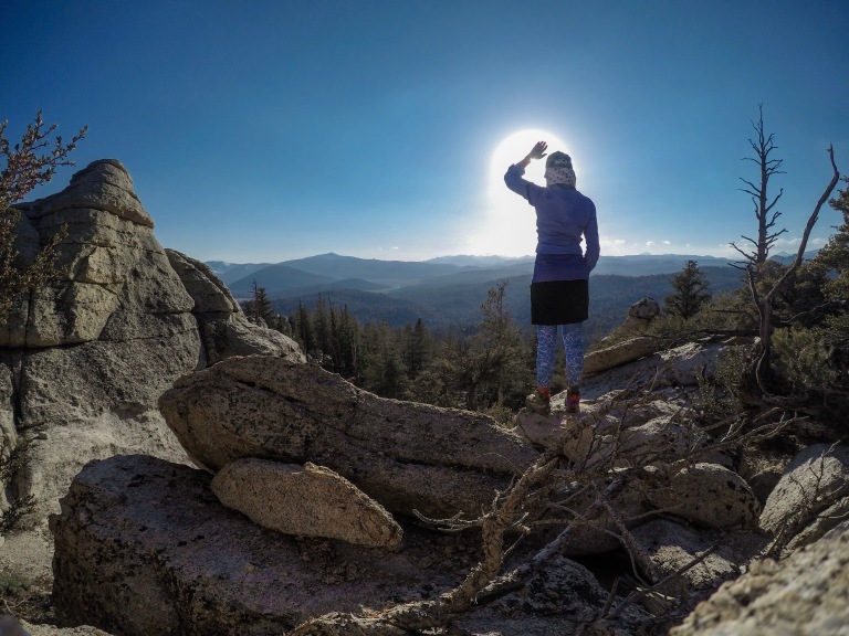 After the first real snow trek of my journey, I came to an open area, snow free, with a beautiful view. I decided to make a hot lunch while pondering my options, as I was still around 3 miles away from Chicken Lake. Although it was still early, the snow was becoming mush; not to mention, I was mentally and physically exhausted. At the pace I was going, I wouldn’t make it by sunset.
I decided to continue for at least another mile, but as soon as I put my pack on, 3 of my new acquaintances showed up. The relief that I felt in my mind and my heart, that I wouldn’t be alone, is indescribable. They said they were setting up camp for the night. I asked them if they would mind if I tagged along with them for the trek up Mt. Whitney. They willingly accepted my company. I just love new friends. I was and still am, so grateful for their company, even if short lived.
 The mosquitos had died down a bit. They built a fire and we ate dinner together.
 I watched the sunset before my tired body crawled into my tent, and my tired eyes forced me into a deep sleep.
Day 43: Mile 747.4 to Mile 763.8
Miles: 16.4
Steps: 54,705
Elevation Gain: 2,650 feet
Well, the 25-30 mile days are in the past now. To hike 16.4 miles, it took me 13 hours. This snow travel is no joke. I was told to get an early start, so the snow will still be frozen, thus easier to walk on. This helps tremendously; however, by 10 am, the iced snow turns to slush, and for the remainder of the day, it feels like you’re hiking in sand. Post-holing (your foot falling through the snow), hasn’t been a big concern yet, thankfully. I am very glad that I chose not to bring snow shoes. They wouldn’t have been helpful.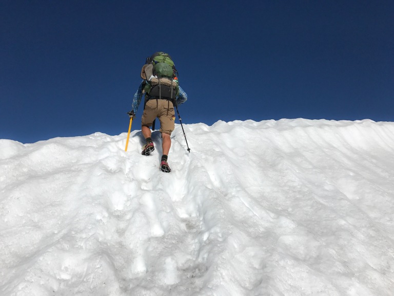
 It was a fun day. It might have taken me forever to get miles in, but it was fun. When snow covers the ground all around you, you kind of choose the trial, but follow the map at the same time. I lost the trail several times, but I didn’t care. To think that I was the first person to walk across the snow coverage over various parts, was pretty neat to think about. I glissaded (slid down a hill on my butt) several times. It’s actually my favorite thing to do.
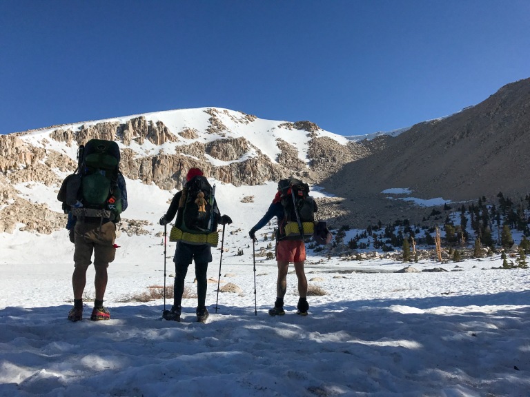 After arriving at Chicken Lake, I knew that I wouldn’t be able to keep up with my new friends, nor did I want to try and push myself to, so I carefully, slowly, and patiently trekked alone for the day.
  I crossed my first larger stream, but thankfully there was a tree that is used to help cross… as long as you can keep your balance. You definitely don’t want to fall off it! I can’t recall the name of the stream, but it was a fairly easy crossing.
Note: keep in mind that I’m not that experienced with backpacking, stream crossings (at all), nor snow travel. So, my reactions and fears (fear of heights), are probably higher than the more experienced hiker.
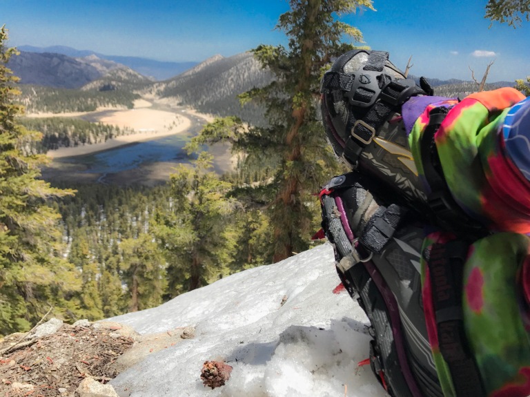 I used my crampons half the day, the other half, they wouldn’t have been useful.
 Plus, it was kind of fun foot skiing and glissading down the mountain. I never felt the need to have my ice axe in hand. I mean sure, I could have fallen down, but it was never off of a mountain, or would have been a very far slide.
I crossed the National Park boundary today (Sequoia NP and Kings Canyon NP). This is also the section of the trail that kind of parallels the John Muir Trail. It’s sooooo pretty. I am sure part of the reason my trek took so long today, was because of the millions of photos I took!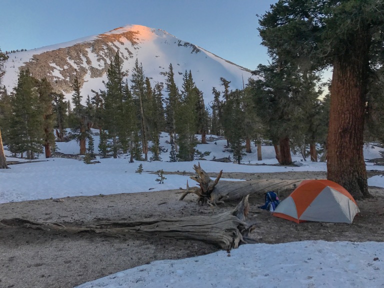 Similar to the day prior, I had planned on going farther than my body was able to go. I ran into my friends, that I had fallen behind from, setting up camp, and after sitting down with them to eat dinner and taking with them, I too, decided to call it a a day.
Unfortunately, one of my new friends was having a bit of pain and needed to get off the trail to see a doctor, so they decided they were not going to be climbing Mt. Whitney. I was on my own again. I was pretty sad to part ways with them, but that’s trail life.
Day 44: Mile 764.8 to Mile 767 (Mt Whitney Junction) to Guitar Lake
Miles: 2.2 PCT Miles; 3.4 Mt. Whitney Miles
Steps: 29,061

The Mount Whitney trek, is not part of the PCT, but a side trail from the PCT. This side trail joins the John Muir Trail (a very very popular trail in the Sierra Nevada), and leads to the summit of Mt. Whitney, the highest point in the lower 48, at 14,495 feet.
In previous years, I am sure most PCT hikers chose to take this optional route. However, with this being the highest snow year ever, a lot of 2017 hikers, chose to skip this hike. I knew that I most likely wouldn’t come back to hike Mt. Whitney and I had spoken to a few people who had made the climb successfully. I knew that if I didn’t feel safe, that I could turn back… at least I thought so..
I knew I wouldn’t be making it to the summit of Whitney before the end of the day, which didn’t leave many miles to travel today, so I decided to take my time leaving, and boy was it nice not to rush before the sunrise.
A lot of the trek was uphill, so I was very glad that I didn’t try to go farther the day prior. I camped at guitar lake, and it sure was pretty! Plus, I met new people and had great company!
 I am writing a separate post about my journey to the summit of Mt. Whitney! I am a bit behind on posting, but I promise I’ll have that one up soon!
Day 45: Mt Whitney Guitar Lake to Summit and back out (12.6 miles) ; PCT Mile 767 to Mile 771.
Miles: 16.6
Steps: 61,605
Elevation Gain: 3.850 feet
 After carefully trekking the 8.3 miles down the Mr. Whitney trail, I was back on the PCT, still pretty eager to keep trekking along. I wanted to get some miles in, since I really only planned for a 7 day stretch.

The snow was already slushy, and taking more energy out of me to complete any miles. Footprints leading in every direction, forced me to continuously route find. A new obstacle became more and more prevalent, which I later learned are called suncups. Suncups are deep holes in the snow, big enough for my foot to fit in, formed by the sun melting parts of the snow and freezing overnight. Each step must be chosen wisely, for twisted ankles, or even broken ankles, can result from stepping wrong.
After an already long day, I was approaching a “creek” crossing, but also a group of people who were also approaching the creek. When I realized that it was one of the creeks that I would actually have to get in and fjord across, fear overcame me. I was quick to make new friends and asked the group if I could cross with them.
I’m not sure if we had the best approach, after reading other hikers approaches the following week. However, I learned a lot and we survived.

Two of my new friends, attempted to test the waters in one location, which they deemed impassable. So, we continued to search upstream for a safer route. Upon finding a “safer” location, we prepared to get wet. The 8 of us, locked arms, and one by one we slowly side stepped safely to the other side. The water wasn’t as freezing as I thought it would be, yet it wasn’t warm by any means. It was high enough to dampen my skirt!
In a short bit, we came to the next water crossing, decided to wait until morning, for hopefully lower water levels, and set up camp… in the snow. My first time sleeping on the snow.
Day 46: Mile 771 to Mile 778.5
Miles: 7.5
Steps: 33,725
Elevation Gain: 2,420 feet
I don’t even know what to say about the low mileage. Walking in snow, up steep inclines, at high altitudes, is so hard. I never imagined it to be this hard. We woke up at 530 to cross yet another river. We were going to attempt it the night prior, but had read that rivers are easier to cross in the morning. Wrong. The river didn’t look like it had gone down at all.
  After walking about a mile up stream, we found the best possible place to cross. The 9 of us, linked arms and slowly side stepped across the river. The water was ice cold and every part of me that was beneath the water was in pain. At one point, the water came up to my waste and I had to fight the current taking me down stream. I had never been so scared of water.
I wasn’t sure if the elevation was really getting to me, the fact that I was starting to get sick, the fact that I started my period (of course on the day I wanted to get over Forester Pass), the river crossings, or the continuous walking on snow, ice and slush, but it was really slowing me down. I told the group to go ahead, because it really was taking me for forever to make it anywhere.
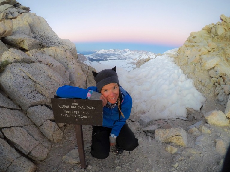
Forester Pass is 14,200 feet in elevation and is the highest point along the PCT. It is the first major pass that I have crossed along the PCT. I didn’t really realize what I was getting myself into. Keep in mind, before I saw this pass in person, I have no idea what a pass actually was. Darker clouds began to fill the sky. At this time. I sent my mom a message on my inReach asking her to google the weather for Forester Pass.
Note: Don’t ask your mother to Google the weather on one of the scariest passes. She later told me that when she Googled it, all these YouTube videos came up and she got worried. Like I said, I didn’t even know what I was getting myself into. Her response, was priceless: “Partly cloudy all day to 8 am tomorrow. High of 43, low of 23. Looks slippery. Are you alone?” Lesson learned! Sorry mom! As I started the 5 mile trek to the top of Forester Pass, I ran into a friend of mine from the first several weeks on the trail. He suggested I camp right before the pass because it would be too dangerous to cross in the afternoon. If I waited till morning, it would be ice and easier, less dangerous to cross. So I decided to stick with him and 2 other fellas.
  We continued to climb, and climb, and climb some more, in the slushy snow. One slip, or wrong step, and there would be a very dangerous descent. It was pretty scary, but not as scary as Mt. Whitney for me… at the time that is.
 We ended up right below the Pass, and boy was it scary looking. Forester Pass is circled in red, in the above photo. Now, I understood my mother’s response. We set up our tents and were in bed by 4pm. As I huddled in my 10 degree bag, with my sleeping bag liner, my down booties, down jacket, beanie and gloves, and was still cold, I kind of jokingly wished a bear would come eat me, so I wouldn’t have to climb the terrifying pass in the morning. That’s when I realized that completing the PCT wasn’t fun anymore. It became super scary and I was constantly anxious about whether I would live the next day, or make it without injury.
  I realize how dramatic this sounds, but for someone who is deathly scared of heights, with no climbing, or much snow experience, I did feel as if my life was in danger. I soon told myself that the PCT wasn’t worth more than my life. There had been several times in the 3 days prior, that I had feared for my life or serious injury. Whether it be crossing freezing, high current rivers; almost getting frost bite after crossing rivers and walking in snow; walking along slushy mountain ridges and slipping several times almost falling off the face of the mountain, crying and wanting to give up; almost falling off Mt Whitney while bouldering; glissading down steep mountains, trying to stop myself by using my ice axe, that I didn’t really know how to use; I realized that as of the day prior; although the snow travel was fun at first, it wasn’t fun anymore. I didn’t want to fear for my life; I didnt want to freeze to death every night; I didn’t want to have wet cold feet all day, every day for 300 miles. That’s not what this was about for me. It was about figuring out what I want to do in life and who I really am, I didn’t come here for this type of adrenaline.
7 or so years ago, I didn’t value my life and would continue, fearless. That wasn’t the case anymore. Thankfully, as I prayed to God that I wasn’t ready to go, I realized when I safely completed this section, God isn’t ready for me either.
Day 47: Mile 778.5 To Mile 788 (+7.5 mile Bullfrog Lake Trail to get to Independence.
Miles: 17
Steps: 53,922
I woke up at 330 am to get started with the group by 430 am. I was so nervous and scared to go over Forester Pass. I convinced myself that I would be fine; panicking would only increase my chances of falling. After expressing my fears to my friend, he said, “Do you see any bodies at the bottom? No, so you’ll be fine”.
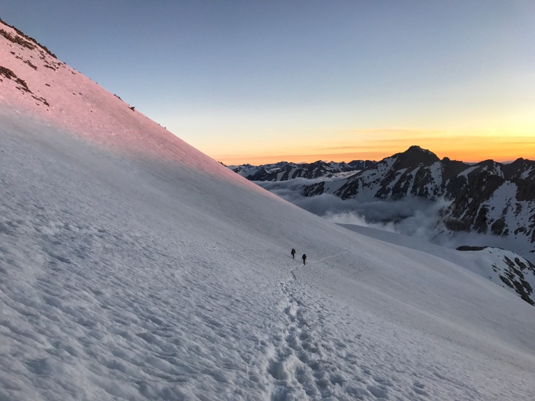
This actually helped. If others could do it before me this year, I could too. And I did. Every step, I convinced myself that I was almost there. Since the trail was not visible, we were forced to follow foot steps up the pass, which was basically like climbing stairs. I probably should have had my ice axe in hand, but wanted the stability from my trekking poles (I should probably invest in a whippet – a trekking pole with an ice axe attached). There was a small part where the trail became visible and upon coming to this part, I sat down on a rock, finally able to breathe and thanked God for my safety. After pushing back the panic and trying not to look down, I took off my crampons and pushed myself to keep walking up the now visible switchbacks. That was until I came around a corner and my eyes focused on what was to come. I wish I could tell you that it looks scarier than it was, but I am pretty sure it was scarier than it looks. I did it though. Very carefully.
What I didn’t think about, was that when you go up, you must go down. When I looked at the footprints going down, I was just as scared.
After making it over Kearsarge Pass, down the wrong side of a waterfall and to Onion Vallry Road, a wonderful family on vacation, took me into independence, where I called my mom, and told her I wanted to come home. I was home 2 days later. No matter my age, sometimes a girl just needs her mother.
Initially I didn’t intend on coming back, but almost immediately felt homesick for the trail. 10 days later, I was back in independence. Stay tuned for the next trek of the Sierra Nevada Section of the PCT!




Thanks for sharing your posts and great photos. You are indeed a brave woman..Congratulations on making it as far as the Kersarge Pass resupply route..I’ve heard that many have skipped the Sierra’s. Hopefully, you will return to complete your journey, if that’s in the cards for you spiritually and physically. Stay safe and use caution on some of the river crossings further north.
Regards, Marc
LikeLiked by 1 person
Thank you!! I did return to finish my journey and am almost finished with the Sierra section! I’ll be posting again soon!! Thank you for following along and the vote of confidence!
LikeLike
welcome back and great to see your post! I would be scared too ( not a fan of heights) but to be scared is human and you gain the confidence after the scary. So being brave and smart you shall conquer. You may have not wanted to come back but I can tell your personality and you would have regretted it had you not. So awesome job getting back on the snow horse! Easier said then done from a PC in Seattle area right. But just take small steps – one day – step at a time. Remember you are in the hardest section of the PCT – once you are out of the high sierra and into Northern California you will have it made. Your mileage will go back up and it will be no extremes the rest of the way. Ok these are my words of encouragement. Thanks for the post, pictures, being brave and coming back and be safe!! We are behind you in spirit.
LikeLiked by 1 person
Awe thank you!!
LikeLike
I have a feeling, things are just going to get better now! Wow. Very impressed . And yes, scary, just reading about it.
Trek on . . . Andale !
LikeLiked by 1 person
Re: Peeing in the woods, are you using a standing urinary device? My sisters started using the She Wee recently and raved about how much easier it made camping and hiking.
LikeLiked by 1 person
I was going to try that, but haven’t yet!! One day, I will give it a go!
LikeLike
beautiful pictures. congratulations on conquering your fears.. also I love the hat!
LikeLiked by 1 person
As always amazing photos, I am glad that you are ok and back on the trail.
greetings from Eastern Europe : )
LikeLiked by 1 person
Thank you so much for following my journey from so far away!!
LikeLike
You sound like me! Scared of heights etc. I’ve read lots of blogs where women and men cry in this trail. Stay safe. Please have the hike if your life well and happy!
LikeLiked by 1 person
Making it to Independence this year is quite a feat. My Dad also attempted to thru hike the PCT this year and he turned around after summitting Mt. Whitney.
I don’t think you are crazy for entering the Sierras solo. Sometimes the choice becomes to go out solo or not at all. Last year, I developed a hard and fast rule for long distance hiking: see the obstacle before making a judgment on it. I heard all kinds of stories about scary passes and chest deep stream crossings only to discover that I felt at home on snow and found knee deep stream crossings every time within sight of the PCT. I know that most of that is because I’m use to snow travel (winter mountaineering is one of my favorite activities), off-trail navigation, and crossing streams. The people who reported to me did not have that experience.
Whether or not you meant to, you met my rule. You saw the obstacle, lived through the fear, and then made the judgment to come off the trail. However, I’m quite happy to read that you have the bug and are now back on trail. I wish you nothing but the best. Just remember, you’re not crazy for moving forward when others turn back and you’re not a wimp for turning back when others move forward. So long as you make your own decisions, you will have nothing to regret in my opinion.
LikeLiked by 2 people
Your words are awesome. Very well said! Thank you. I needed to hear some of that!!
LikeLike
Girl, this sounds like a wrote it. Hence why I am sitting in my living room living vicariously through you. I am afraid of heights as well. I get out there and hike but don’t always enjoy some of the trail because of the drop offs. I applaud you and I am so glad you have God in your life. He is your lifeline and he will keep you safe. Through him all things are possible. Enjoying your journey. I hope it gets easier.
LikeLiked by 1 person
Thank you so much for following along! I couldn’t have come this far without God! I didn’t think the heights thing would get easier, but it has, so there is hope!!
LikeLike
You are one brave and amazing girl!!! Congratulations on conquering Forester Pass! Thanks for all the great posts and photos.
LikeLiked by 1 person
Awe thank you for following along!!
LikeLike
Wanderlust,
Wow!! Good job on the push through: mosquitos, snow, rapids and the fear.
The Bible says to not fear around 40 times so try and remember that and take one icey step at a time. We will up our prayers for you and your Mom.:)
I can totally relate to what your mom is going through. Our 34 year old son just came back from ice climbing Alpamayo in Peru. Yes, we believe in the power of prayer!
You are amazing !
Blessings
The Moore’s
LikeLiked by 1 person
It’s so good to hear from you!! Feel free to message me on Facebook (Daniele Clarissa). I needed to hear that, next time I am scared, I will remember that the Bible says fear not. Thank you so much. Your son sounds pretty adventurous as well!!
LikeLike
Well done on completing another challenging stage. Life is a journey and it’s the journey that you are sharing that is inspiring all of us who follow your blog including this one on the southern tip of Africa. Keep the Faith.
LikeLiked by 1 person