
When I visited Southern Utah and Northern Arizona several months ago, I fell in love with the Southwest. My main motive for returning to the Glen Canyon area was because I was chosen for a permit for the world famous hike in Coyotte Buttes North, called The Wave. So, I booked a plane ticket, a four wheel drive rental SUV and planned my vacation around The Wave. Here are my five days of Southern Utah and Northern Arizona hiking adventures.
Time of Year: June
Peak Temperatures: 105-115°F
Day One
There were so many hikes that I wanted to complete during my short visit, so I didn’t have any time to waste. I hoped on a plane from Seattle to Las Vegas and was in the rental car before noon. I stopped by Walmart to get a cheap cooler, bottled water, ice and food for the week and was ready to hit the trails. First stop, just outside of Kanarraville, Utah and the Kolob section of Zion National Park.
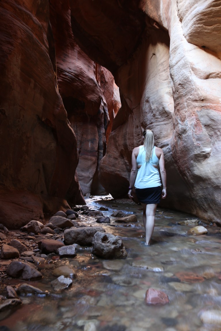
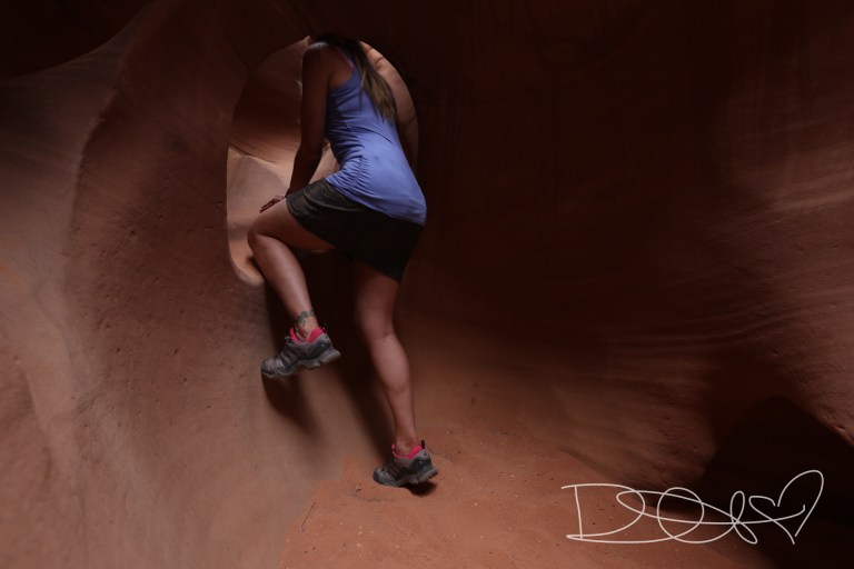
Kanarraville Slot Canyon and Kanarraville Falls

Trail Distance: 3.5 miles RT
Difficulty: Moderate (due to trail obstacles and creek hiking)
Time: 3-4 hours (due to photographing the falls)
Trail Crowds: Although about a dozen people were headed back to their cars when I started the trail at 3pm, I had the waterfalls to myself! However, I have read that this is a very popular trail and can get very crowded.
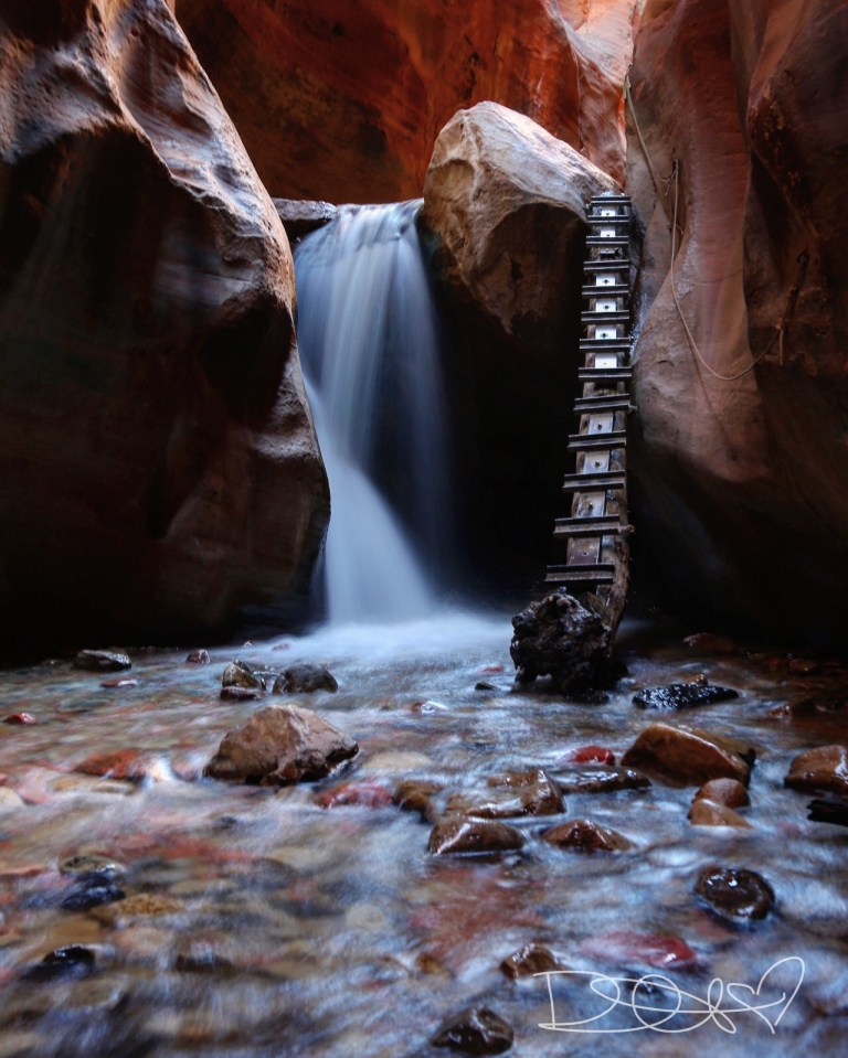
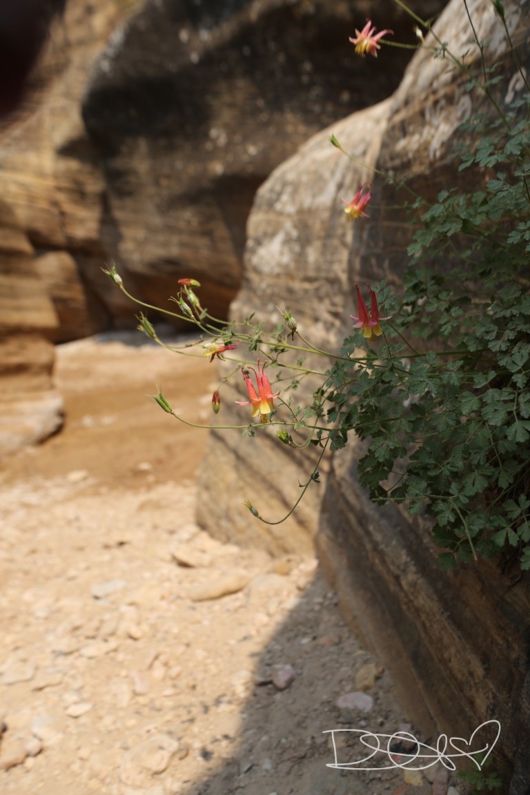
Description: This trail takes you along side Kanarra Creek and through Kanarraville Slot Canyons to two very photogenic waterfalls. Since I went on a very hot day in June, I loved hiking through the creek and although a lot of the trail leads you along side the creek, I often chose to walk in the creek to cool off, with less scrambling over nature’s obstacles. This hike is absolutely on my top ten favorite hikes list.
The scenery was beautiful the entire hike, the creek was great for cooling off in the warm weather, the slot canyons were awespiring, and there were two awesome waterfalls along the way.
I found the trail’s obstacles to be a rather fun and exciting challenge: scrambling up a natural waterslide/waterfall, climbing up wooden ladders along side the two waterfalls, and hiking over several boulders and tree roots.
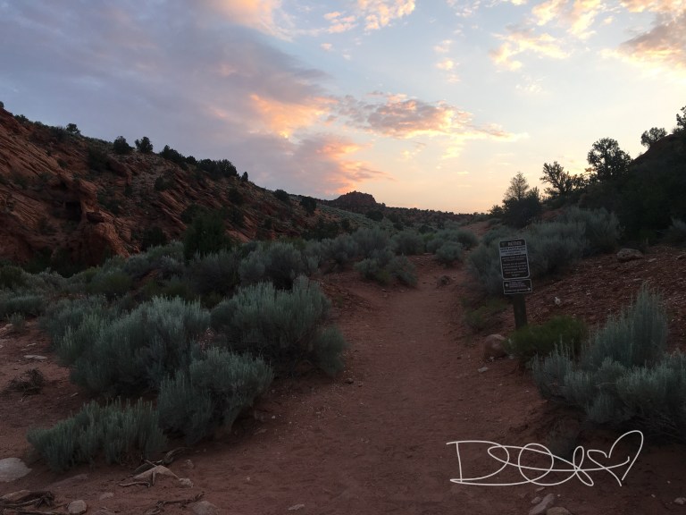
After returning to my car, putting on some dry clothes and eating a few snacks, I set out to the Para Information Center, in Kanab, Utah, where I would pick up my Coyote Buttes North hiking permit for The Wave. By the time I arrived in Kanab, it was dark and I was exhausted, so I went to one of the camp sites near The Wave and there were a few cars in the parking area and only 5 tent sites.
With it being so late, I decided to sleep in the car for the night. However, shortly after I inflated my sleeping pad across the trunk and back seats of the SUV, I heard a faint whistling noise and my body started to sink to the floor of the trunk. I soon realized that something punctured my sleeping pad and I soon began struggling to stuff clothes and my sleeping bag into crevasses to get comfortable. All the while, my body is poorly adjusting to the extreme heat, my nose is beginning to stuff up from the dried blood accumulated due to the lack of humidity, and the light of the full moon is shining in my eyes; all of which making it impossible to relax. I accepted the fact that if I wanted any sleep, I needed to get to a hotel. I ended up at an over priced Motel 6, but it was worth it for a bed and a shower.
Day Two
I had to pick up my permit for Coyote Buttes North The Wave the day before my hike, so that was my priority on day two. My initial plan was to pick up my permit first thing in the morning and then go to Spooky and Peekaboo Slot Canyons, but two things prevented me from doing this. First, I slept in and took my time getting my gear together, and secondly, I didn’t realize that Hole in the Rock Road was almost 3 hours away, despite being in the same National Monument area as Coyote Buttes North. So, I decided on a shorter hike, Willis Creek Canyon, which was fairly close to Coyote Buttes North.
Willis Creek Canyon
Trail Distance: 2.4 miles RT
Difficulty: Easy
Time: 1-2 hours
Trail Crowds: This is a less traveled crowd, so there were only 3 other people I crossed paths with. Although pretty in areas, I don’t know that this is a hike that I will remember, nor would I recommend anyone adding this to a bucket list, unless you are in need of a short hike to waste some time.
Day Three
The day I had been waiting months for, was finally here.
The Wave: Coyote Buttes North
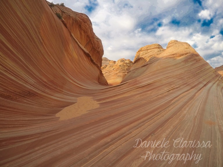
Trail Distance: 5.5 miles RT
Difficulty: Moderate
Description: After waking up at 430am in my car, I started getting my gear ready, put my pack on and was ready to start the hike by 515am. I ran into a middle-aged couple that were also preparing to hike. I asked the gentleman, to get some reassurance, which way the trail was and he pointed and then rudely asked me, “Do you even have a permit?” Who the hell are you sir? The permit police?! Yes, I have a permit, it is bright pink and hanging from my pack. Thank you for your concern.
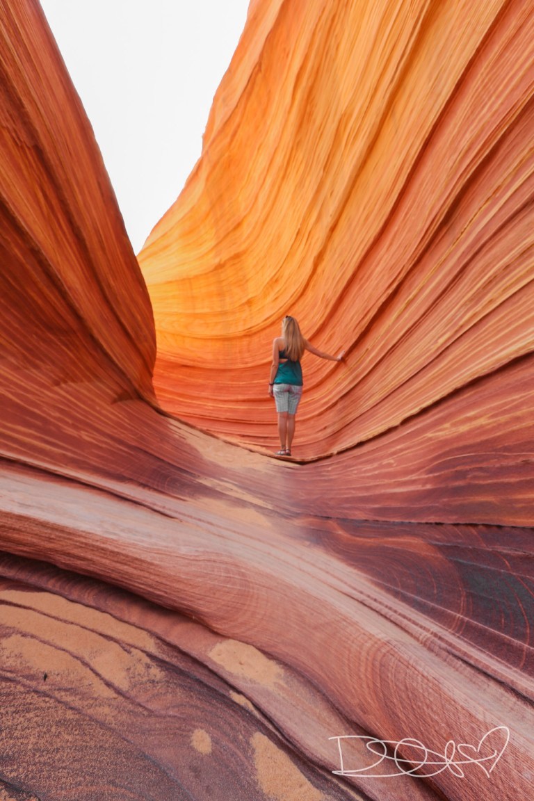
The visitor center gave me a map and directions to the Wave, which were incredibly helpful. The handout she gave me, had pictures of landmarks to follow in order to get to the Wave. That, and my handy dandy InReach GPS device, made it fairly simple; however, I can see how one could easily get turned around.


Yes, the Wave is every bit as awesome as the photographs. I was the only one at the Wave for a good hour. There were half a dozen people starting to show up, as I was packing up all my gear. The weather was so perfect; just the right amount of clouds in the sky to make it even more photogenic.
Day Four
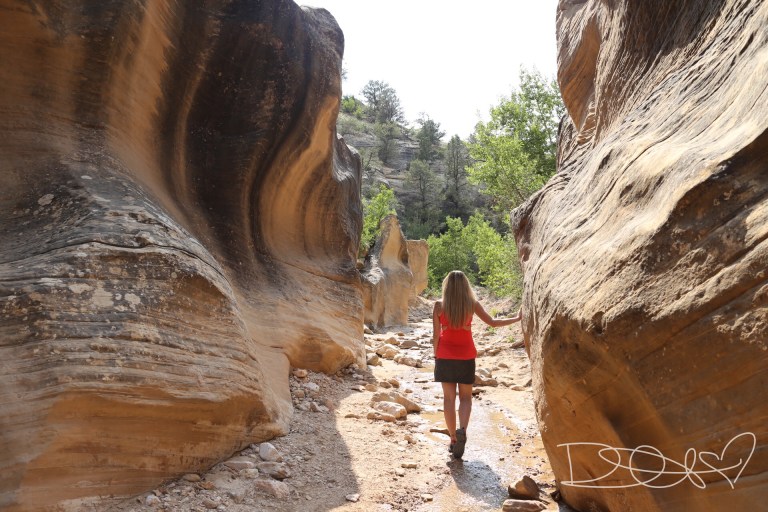
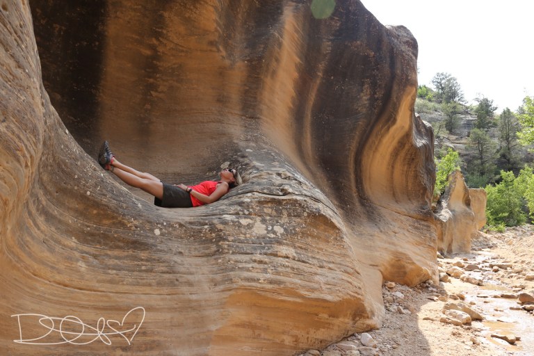
Peekaboo & Spooky Slot Canyons
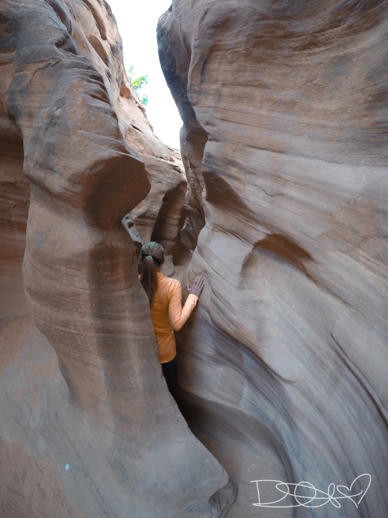
Trail Distance: 2.5 mile loop
Difficulty: Easy to Moderate
Warning: Please check weather reports and inquire at the ranger station about the possibility of flash flooding prior to hiking this, or any slot canyon!
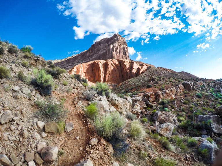
Description: Peekaboo and Spooky Slot Canyons are pretty awesome. After going to Antelope Canyon my last visit, I fell in love with slot canyons, so I had to visit more of them. This area of the Grand Escalante Staircase is about 3 hours away from the Coyote Buttes area, but very close to the hike I was doing the following day. The trail head is located off Hole-in-the-Rock Road and although only 26 miles down the road, because of the pot-holes, deep sand and rocks, it takes quite a bit of time to drive this 26 miles. It is suggested to go up Peekaboo and down Spooky, which is what I did. It could be quite challenging out the opposite direction.


It was a really fun hike, paired with some climbing, sucking in your tummy and taking off your pack to fit through some areas of the slot canyon. Despite being a shorter hike, I thoroughly enjoyed this adventure.
Day Five
Reflection Canyon Attempt
Trail Distance: 18 miles RT
Difficulty: Difficult
Description: My intent for day four was to hike to Reflection Canyon, in the Glenn Canyon Recreational Area, which a simple internet search will reveal the beauty of this location. No trail exists to Reflection Canyon; GPS navigation is required. I was new to my InReach device and although I set a waypoint for my starting location and for Reflection Canyon itself, I did not set waypoints in between the two. I was using a picture saved to my phone of a route someone else took to get there. Well, I obviously was way too confident in my navigational skills.
I set out with my overnight pack, food, and 11 liters of water for the two days. My plan was to get there for sunset, camp, watch the sunrise and head back. This is not what occurred. My first mistake, I didn’t pay attention to the elevation contour lines on the map. I ignorantly thought it was quite odd how the map I was following went on what I thought appeared to be a longer route; now I know why. The way I started to take, took me up and down very large hills. Two miles into the hike, I was already exhausted, hot, and dehydrated. My second mistake, I followed what I thought looked like a trail with footprints and this took me to a dead end in a large slot canyon; a 2.5 mile detour.
By the time the sun was setting and I had already hiked 9 miles; I was still 3 miles from my destination.
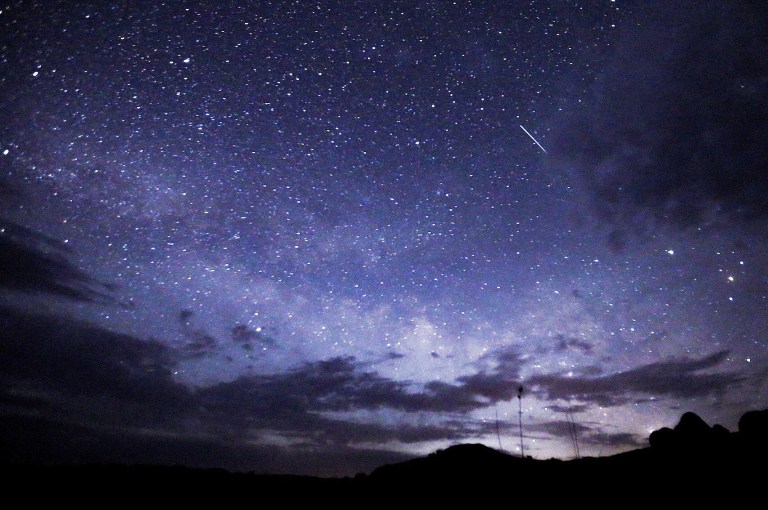
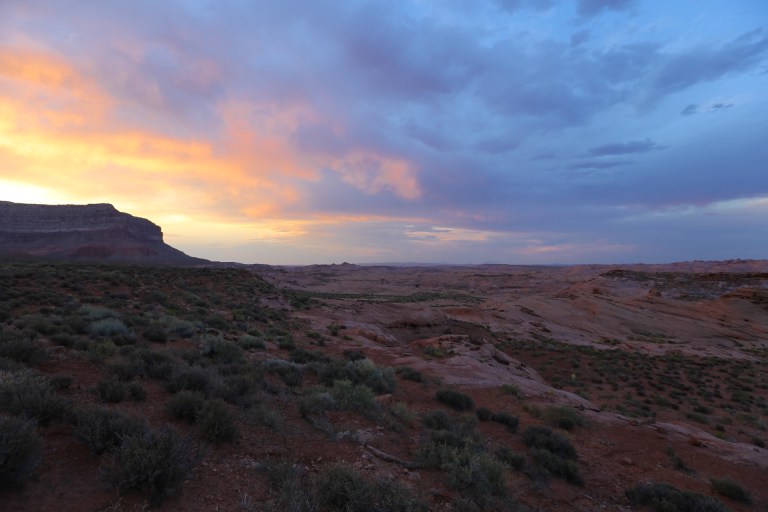
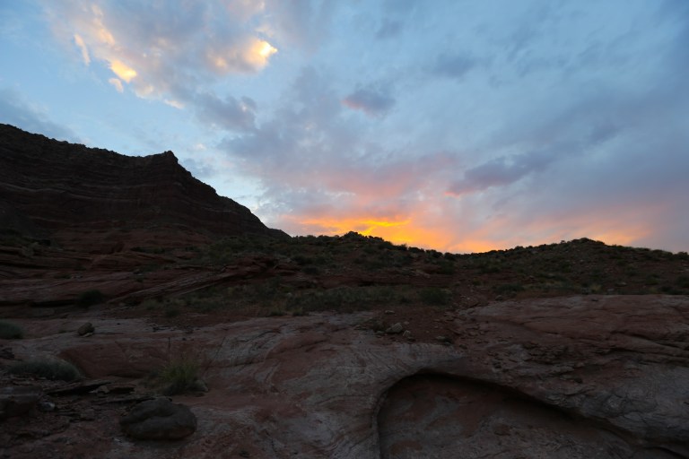
I set up camp, and although I didn’t make it there, I was not disappointed with the sunset and the amazing night sky.
As I lay down, I could feel the effects of dehydration, despite drinking 6 liters of water, and was not able to sleep. I decided it was best to head back in the morning and, accept defeat. I will attempt this again, one day.
The next morning, I sluggishly made it back to my car in only 6 miles, having learned a lot of route lessons on the way out.
Horseshoe Bend

Trail Length:
Difficulty: Easy
I simply couldn’t leave without visiting Horseshoe Bend again. It is one of my favorite places to watch the sunrise and sunset.


I stayed quite late and watched the sunset on the solstice with a strawberry moon. A girl couldn’t ask for anything else! Next stop, Vegas to recover and pamper myself!
10 Lessons I Learned About Desert Hiking
- Desert sunrises and sunsets are quite epic!
- Never underestimate the desert sun! The heat and dryness will create an increase in the amount of water your body needs. Not to mention, you have to carry all the water you need because there aren’t many alpine lakes to filter from in the desert!
- Before you say that 110 degrees in the desert isn’t hot because of the lack of humidity, go hike in it! The southwest had record breaking temperatures the week that I visited. Many people make the comment, “but it is a dry heat”. These people must not have hiked in this 105-115 degree “dry heat”. I don’t care who you are, 110 degrees is flippin’ hot and the dryness of the air makes it so your sweat evaporates more quickly, causing dehydration at a faster rate. So much so, that 5 hikers died in Arizona during this week related to the heat.
- Your body dehydrates faster in the desert. Carry enough water for your entire hike, plus more! If you’re not near a water source, don’t count on running into one!
- A high clearance, four wheel drive/all wheel drive vehicle is almost required for hiking in the Grand Escalante Staircase National Monument area; although my Honda Civic has taken me many places, this is not one of them. The dirt roads, boulders, and ginormous pot holes make it almost impossible for a smaller vehicle.
- Fire ants are no joke. Watch where you step!
- There are jack rabbits everywhere when driving. Stop the car for them; they have no idea where they are going; they will cross the road 3 times before you’re safe to continue.
- Don’t pee outside in a sandstorm. Need I say more?
- Desert hiking sucks balls.
- Waterproof shoes are not the shoes for the desert… They hold in the moisture. Swollen feet, moisture… the perfect blister environment!
Southern Utah and Northern Arizona hiking adventures are amongst my favorite! If you haven’t explored this area, please add it to your bucket list!

Awesome reads! I Don’t use the i gram that much so did not even realize you could blog post like this. Igram just went up in opinion.
I too have been in this area. One of my faves to explore. You must have done the online permit for the wave / Buttes. The way to go in my opinion. I have been to the kanab blm lottery twice and have not won either time. So many people cram into that office. It is kind of cool unless you don’t win, twice. Luckily lots of great slots hikes in area as you mentioned. I really liked buckskin gulch ( same parking area for wave and same trailhead. )
Love your adventure spirit. Sound like a broken record. Your writing ability is only surpassed by your photography talent. I am envious of that.
Safe travels.
LikeLiked by 1 person
Wow… thank you so much. That’s probably the nicest thing anyone has said on here! I did do the online permit…. that entire area is just so gorgeous. I could go back a thousand times and not visit all the beautiful places. Thank you for your kind words and support.
LikeLike
More gorgeous photos, love them and your writing too! Thank you for sharing!
LikeLiked by 1 person